1800's
- Title
- 1800's
- Subject
- [no text]
- Description
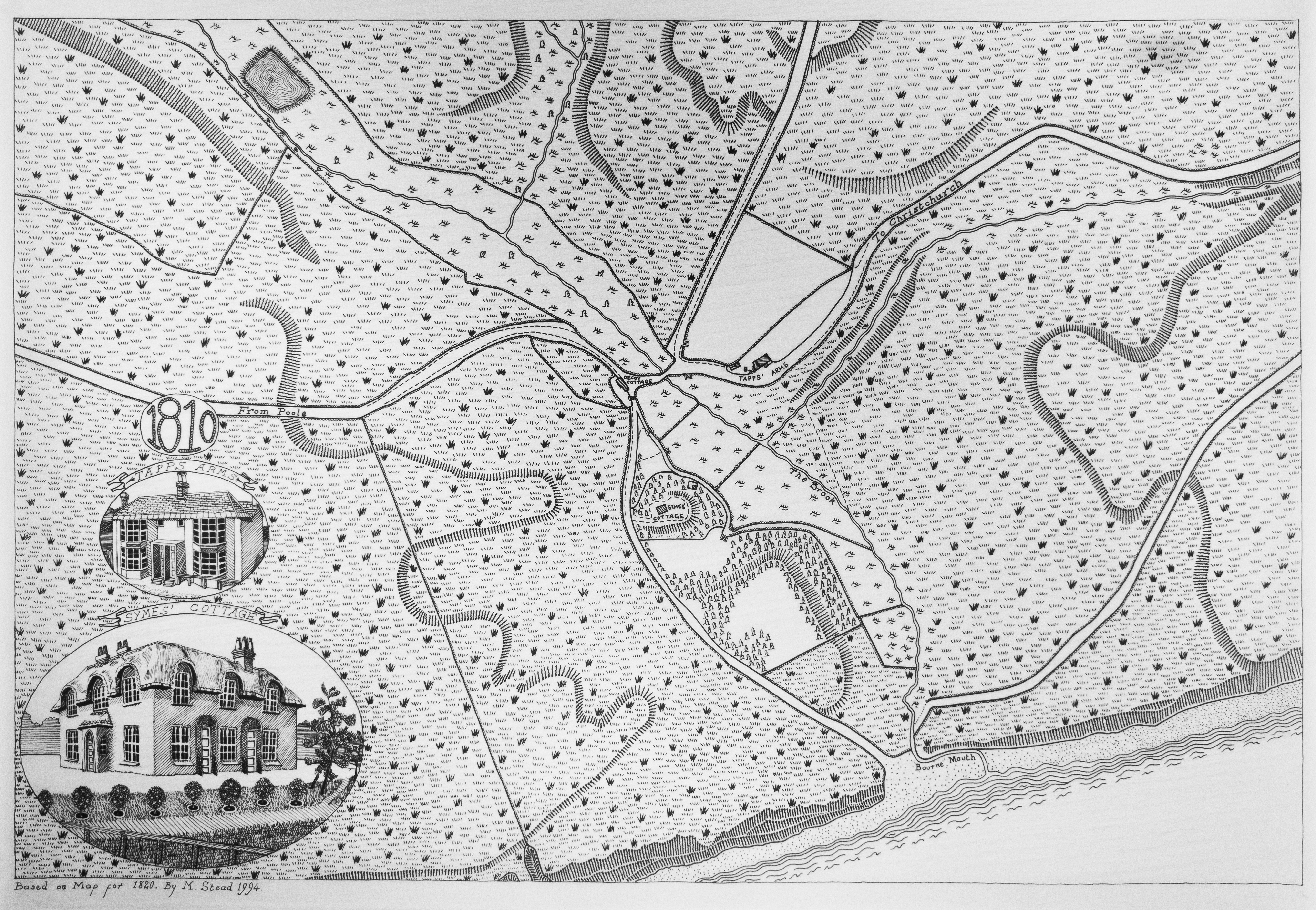
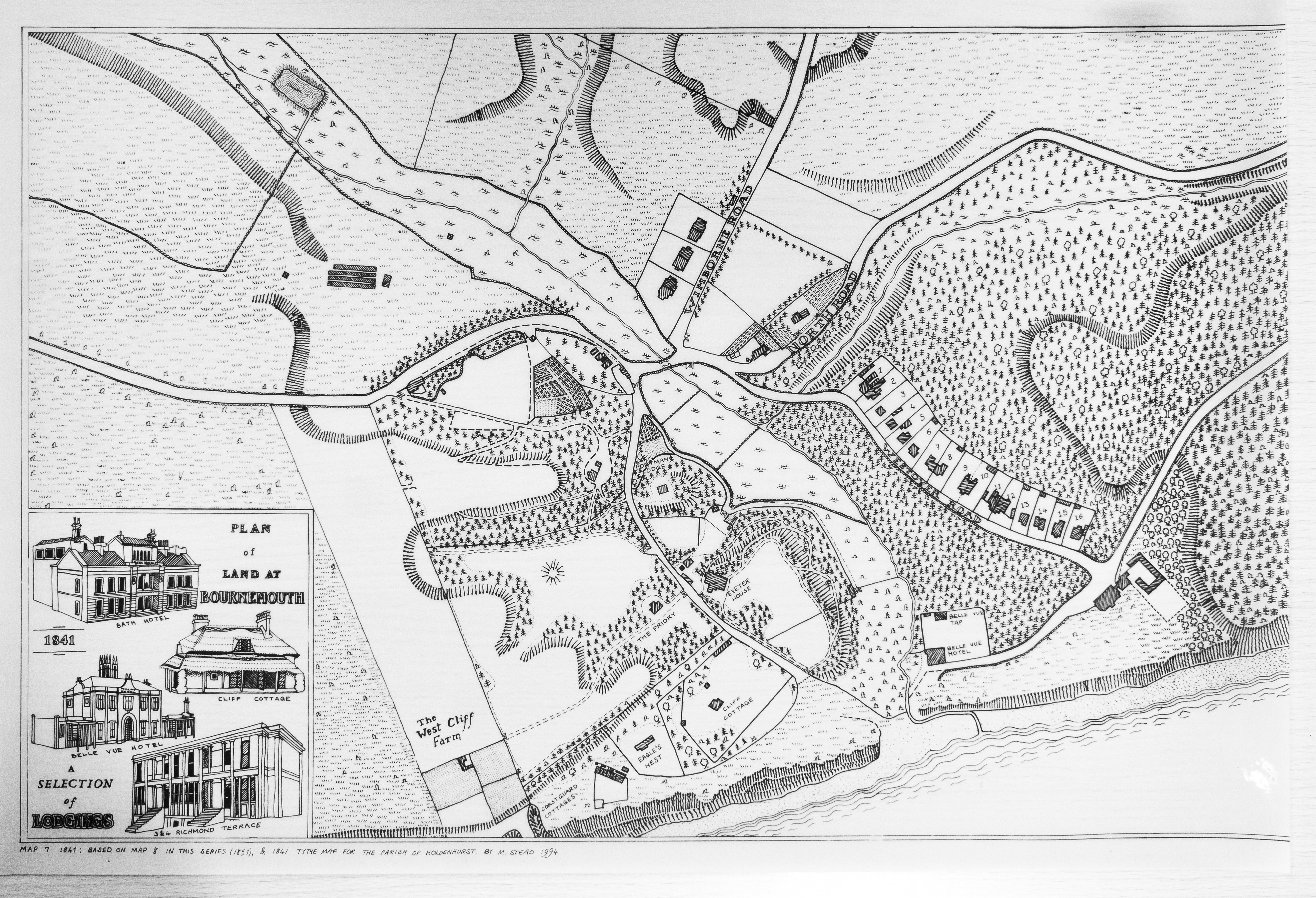
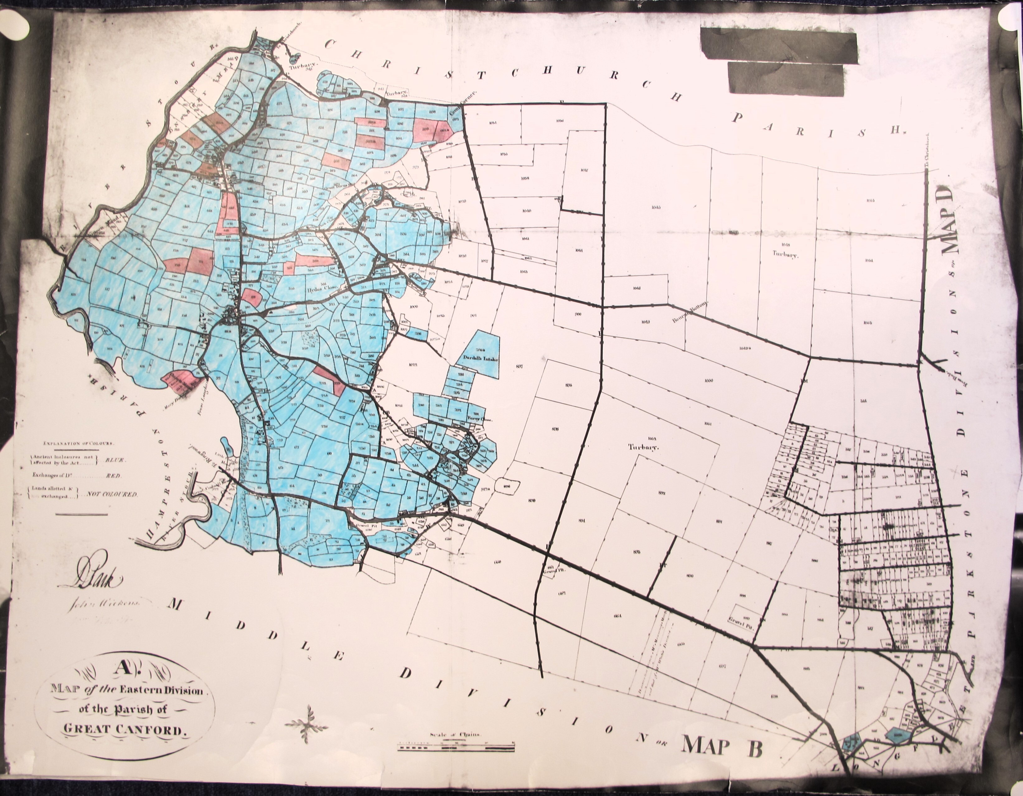
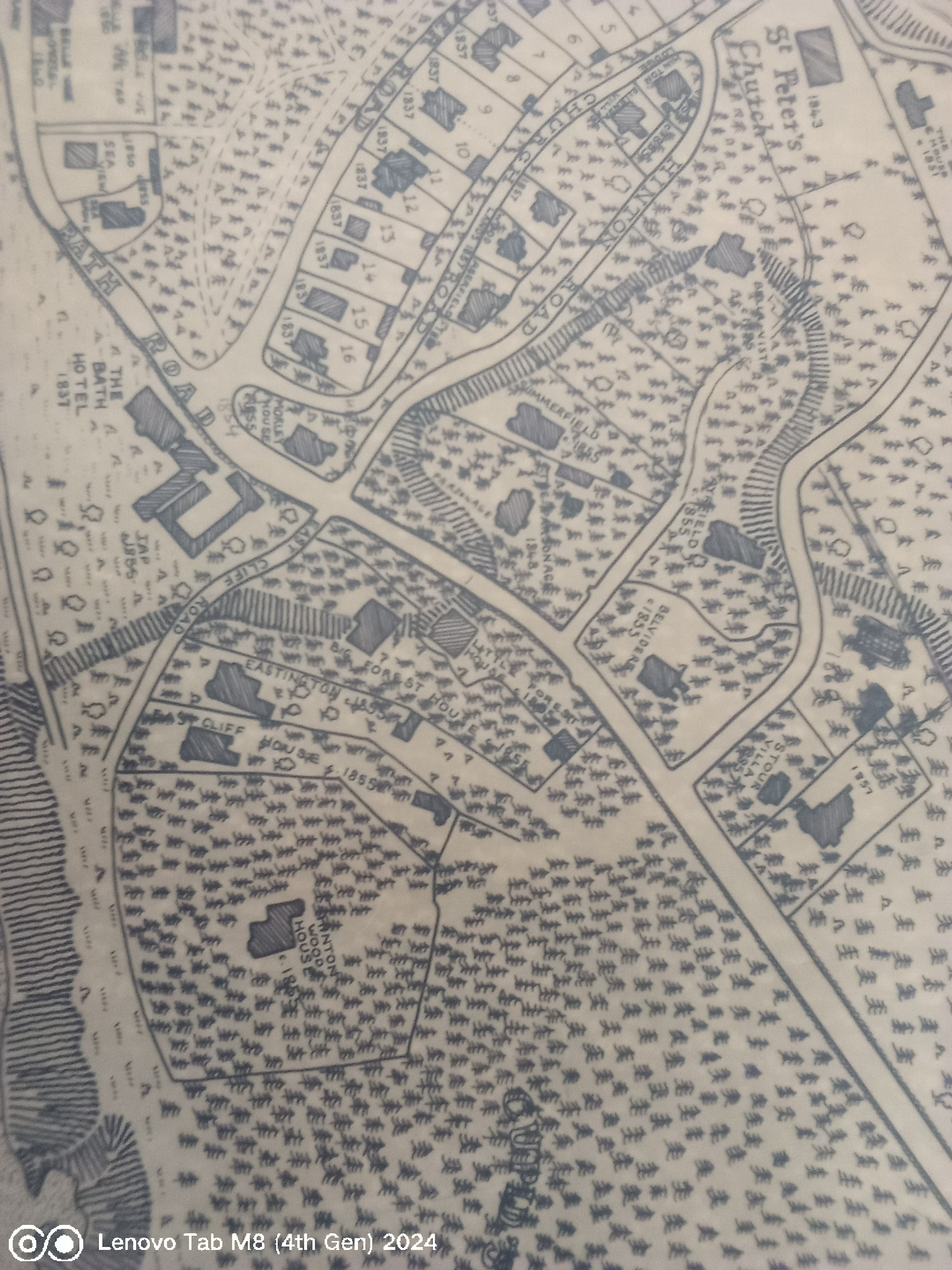
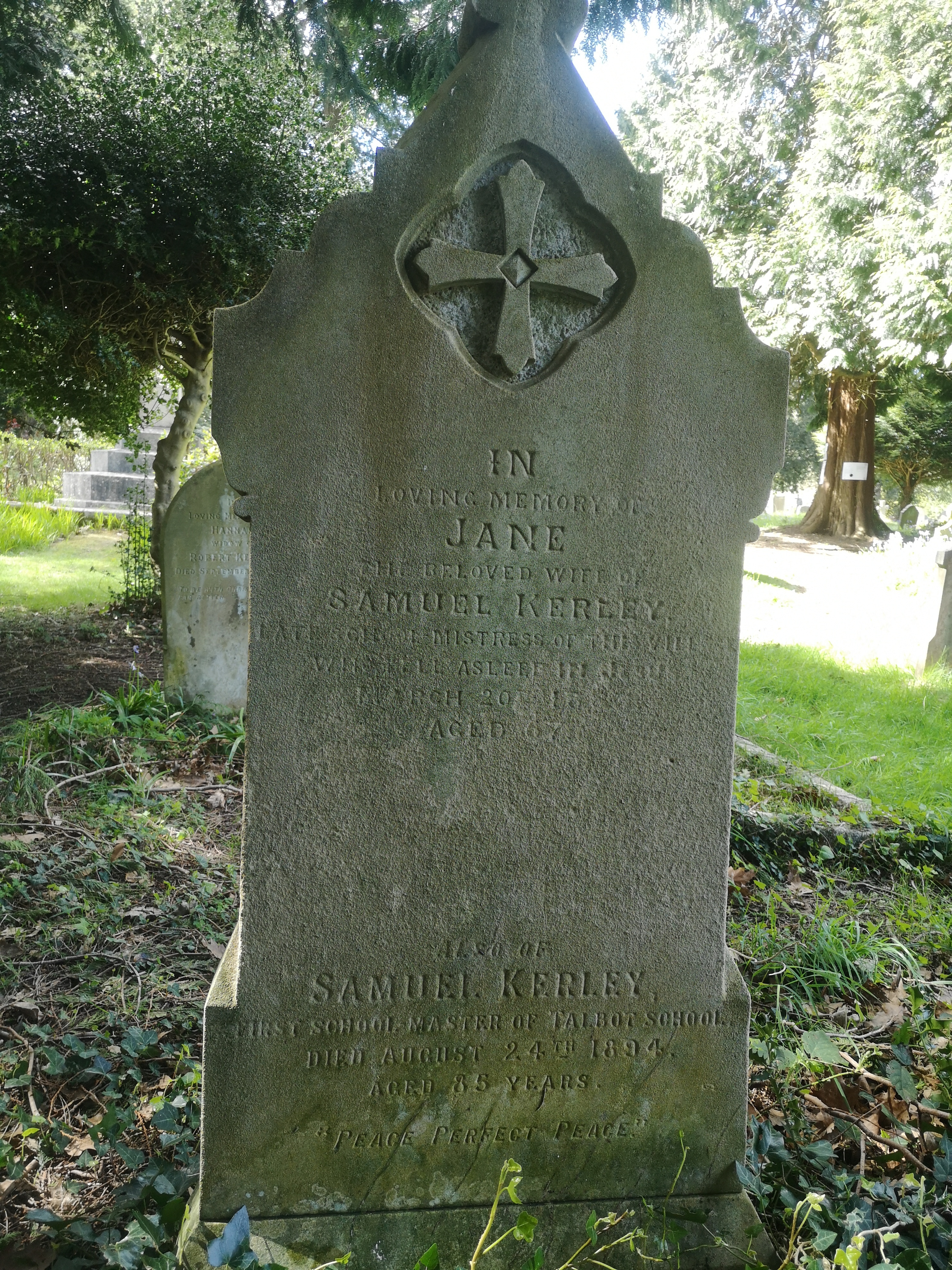
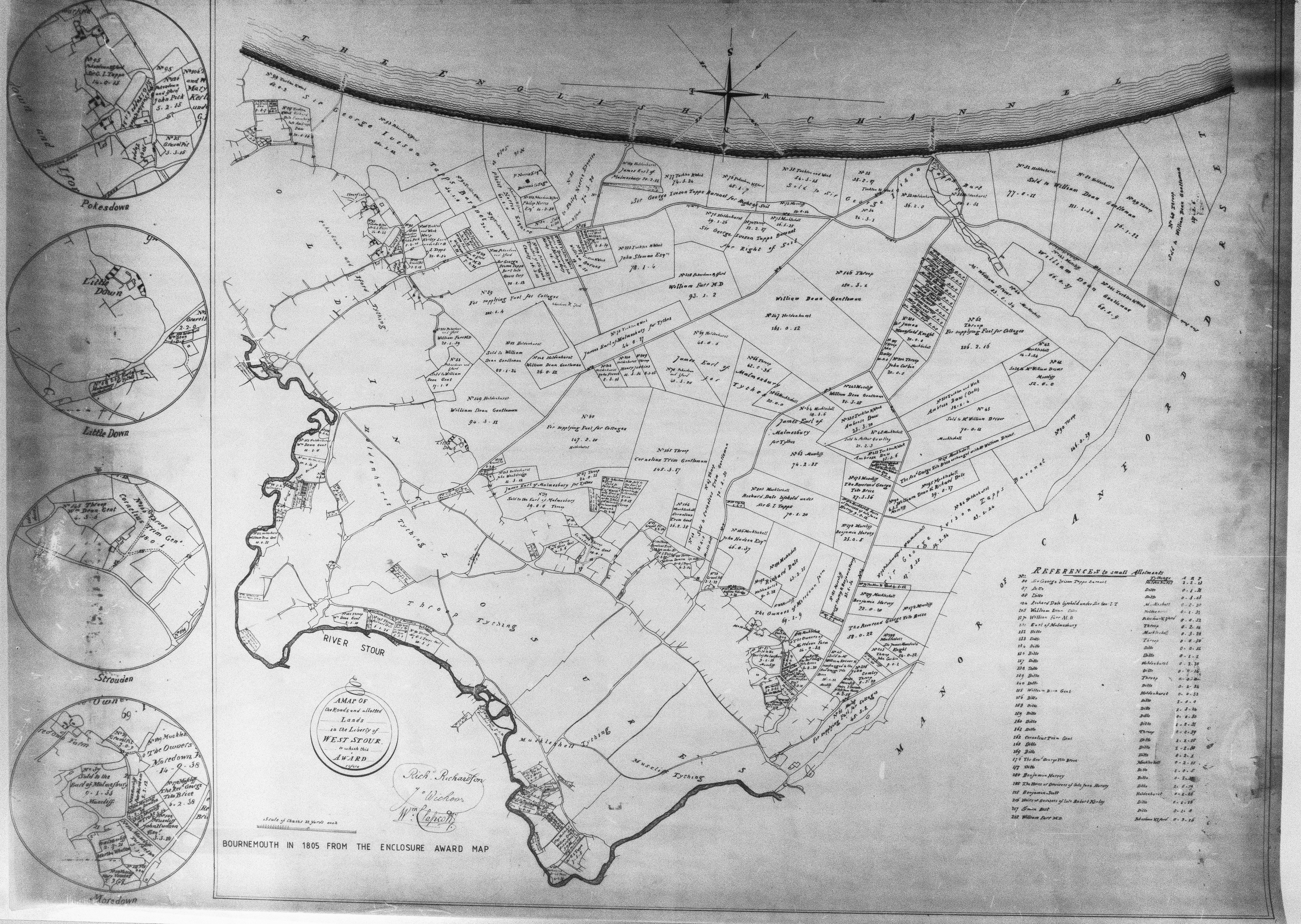
- Talbot Village History in the 1800's
- Creator
- [no text]
- Source
- [no text]
- Publisher
- [no text]
- Date
- [no text]
- Contributor
- [no text]
- Rights
- [no text]
- Relation
- [no text]
- Format
- [no text]
- Language
- [no text]
- Type
- [no text]
- Identifier
- [no text]
- Coverage
- [no text]
Dublin Core
Collection Items
Rifle_Range_1899.png
Map of Rifle Range
Rifle_Range 1880.png
Rifle Range Map
Rifle_Range 1880.png
Map of Rifle Range
1870_OS_Winton_Map.png
Winton Map
1805_Map_Charles_Bugden.png
Charles Bugden Map
IMG-8183_Extract_1820's_boundaries-Talbot-Heath.pdf
Tablot Heath Boundary Map
History of Talbot Village Full Book.pdf
History of Talbot
1893_Bournemouth.pdf
Bournemouth Map
1883 map showing education disposals 1948 - 1980.pdf
Map Showing Education Disposals
1883 boundary on modern map base.pdf
Map of Boundary 1883
Village of Winton-1865.jpg
Winton VIllage Map
Village of Bournemouth-1851.jpg
Bournemouth Village Map
The Mansion-1820.jpg
The Mansion Map
Terrace Cottage-1835.jpg
Terrace Cottage Map
Talbot_Heath_Lidar.jpg
Aerial Photo of Talbot Heath
TALBOT WOODS, (NOW, WALLISDOWN RD), 1876.jpg
Talbot Woods Photo
TALBOT WOODS c1890's.jpg
Talbot Woods Photo
Symes Cottage-1820.jpg
Symes Cottage Map
Surrey_Road_Boundary_3.jpg
Surrey Road Boundary
Surrey_Road_Boundary_2.jpg
Surrey Road Boundary
Surrey_Road_Boundary_1.jpg
Surrey Road Boundary
Smith V Durrant-1857.jpg
Smith V durant Map
Plan of St Peters district-1823.jpg
St Peters Map
Plan of Freehold Land-1865.jpg
Freehold Land Plan Map
New Marine of Bourne Village-1838.jpg
Bourne VIllage Map
Longbottom_Range 8.jpg
Photo of Longbottom Range
Longbottom_Range 7.jpg
Photo of Longbottom Range
Longbottom_Range 6.jpg
Photo of Longbottom Range
Longbottom_Range 5.jpg
Photo of Longbottom Range
Longbottom_Range 4.jpg
Photo of Longbottom Range
Longbottom_Range 3.jpg
Photo of Longbottom Range
Longbottom_Range 2.jpg
Photo of Longbottom Range
Land Plan of Bournemouth-1851.jpg
Land Plan of Bournemouth Map
IMG_8183.JPG
Great Canford Map
Hinton Wood House map.jpg
Hinton woods Map
Enclosure Award Map 1805 - Top Right - Museliff.jpg
Enclosure Map Part
Enclosure Award Map 1805 - Top Left - Poole Lane.jpg
Enclosure Map Part
Collection Tree
- 1800's


